Saturday, 22 June 2013

Race-the-sun write-up Part 11 - Made it!

This compass rose on the beach at Whitesand's Bay points to various features in and around the bay. One of them is South Bishop Lighthouse. Those who appreciate the meditative cadences of the BBC Shipping Forecast - or indeed seafarers who need to listen to it - will be familiar with the name.

I arrived at Whitesands Bay, on the coast just outside St David's, to find the place buzzing with young people aiming for a beach bonfire (it was a little too large and ramshackle to call it a 'barbeque') and quite a few athletic types on surfboards. The weather turned wet and very windy, but none of them were deterred.
Me, I just put my helmet and gloves back on and sat down on the beach to wait for [the time of] sunset. They must have thought I was a right nutter, but with the helmet on, I couldn't see or hear them so it mattered not a jot.  The two guys I met at Lowestoft didn't show. They mentioned having booked a pitch at a local campsite, so I imagine they were not quite so mad after all and had decided to hunker down for the evening.


Despite having been lightly poached by the sun all afternoon in my all weather riding suit, there was nothing of it to be seen at sunset.


That's that, then. Around 400 miles and 15 hours. That includes a few of those involuntary detours, but it was still a very enjoyable day out.  I set off home straight after [the time of] sunset, stopping for the night at a Travelodge before hitting the M4 and A350 in the morning.

Now, as Bilbo said, I'm quite ready for another adventure.  Something ridiculous on that little scooter of mine, maybe. Do send suggestions.


Race-the-sun write-up Part 10 - Now there's something you don't see every day


Pelcomb Service Station, the last petrol west of Haverfordwest, is a jolly useful place to make for. Beside the groceries and charcoal and cash machine and girlie mags and so on - and petrol, of course - there was a surprise inside...


... a chip shop! I was in good time, so I sampled a portion of chips with a sausage, just as a matter of research, you understand. They were great. But when I passed again a little after sunset, about half past nine, they were already closed, so dine early!


Race-the-sun write-up Part 9 - Trecastell, Llandovery

Blink and you'll miss it on the A40 in the Brecon Beacons
Trecastell is a blink-and-you-miss-it sort of town, but it will have a special place in the heart of many an ex-pongo. It was the last outpost of civilization before turning right onto a track up into the Brecon Beacons for two weeks of mud and rain, learning how to fight a mythical enemy who had exactly the same weapons as us and attacked over temperate moorland. (So that's why we won in the Falklands!)


But Trecastell has come on a bit since I was last here. I noticed a cafe offering WiFi. And there is this street, which is no doubt where they connect to the Llan.


Llandovery gets its share of visitors, what with its wee castle and cattle market and craft shops, but I thought I'd mention this by way of a public service: the car park is overseen by the ghost of Glendower, seen here in shiny stainless steel robes. (The shiny stainless steel robes is all you see; the rest is ghostly empty space; very effective.) Improperly parked cars will be lanced.


While in Llandovery, I spotted the West End Cafe, which I had noticed on Google Streetview some while back. This seems to be a popular stop for the many visiting motorcyclists drawn to the area by the gloriously scenic roads. I thought I'd call in for a cuppa and possibly a chat. But when I arrived and did my usual cheery greeting, the three chaps out the front totally blanked me. They could've been Welsh, of course, but I think the problem was that they were what my brother-in-law, Chris, astutely identified as MAMILs (middle aged men in leathers). They ride sporty bikes very fast. Typical conversation might be 'I red lined on the B1586 and totally smoked a bloke in a 911.' I am a MAMID (...Dacron). Mamids ride ponderous touring bikes frugally. Typical conversation might be 'Oo! Look! Pwitty! Let's stop and take some pictures.' When I turned up, they looked at the bike, the Dacron, and especially the collar and tie (see previous entry, http://bigrideforcancerresearch.blogspot.co.uk/2011_08_01_archive.html, under 'Togs'), and could make neither head nor tail of me. There are many breeds on two wheels, just as there are many on two legs. Just as you wouldn't expect a baboon to have the time of day for a booby, there is no automatic affiliation between the leather blokes and the Dacron blokes, the Harley cruiser and the scooter buzzer, or the off-road puddle-duck and the chrome-polishing classic owner.

Race-the-sun write-up Part 8 - Malvern Hills, again.

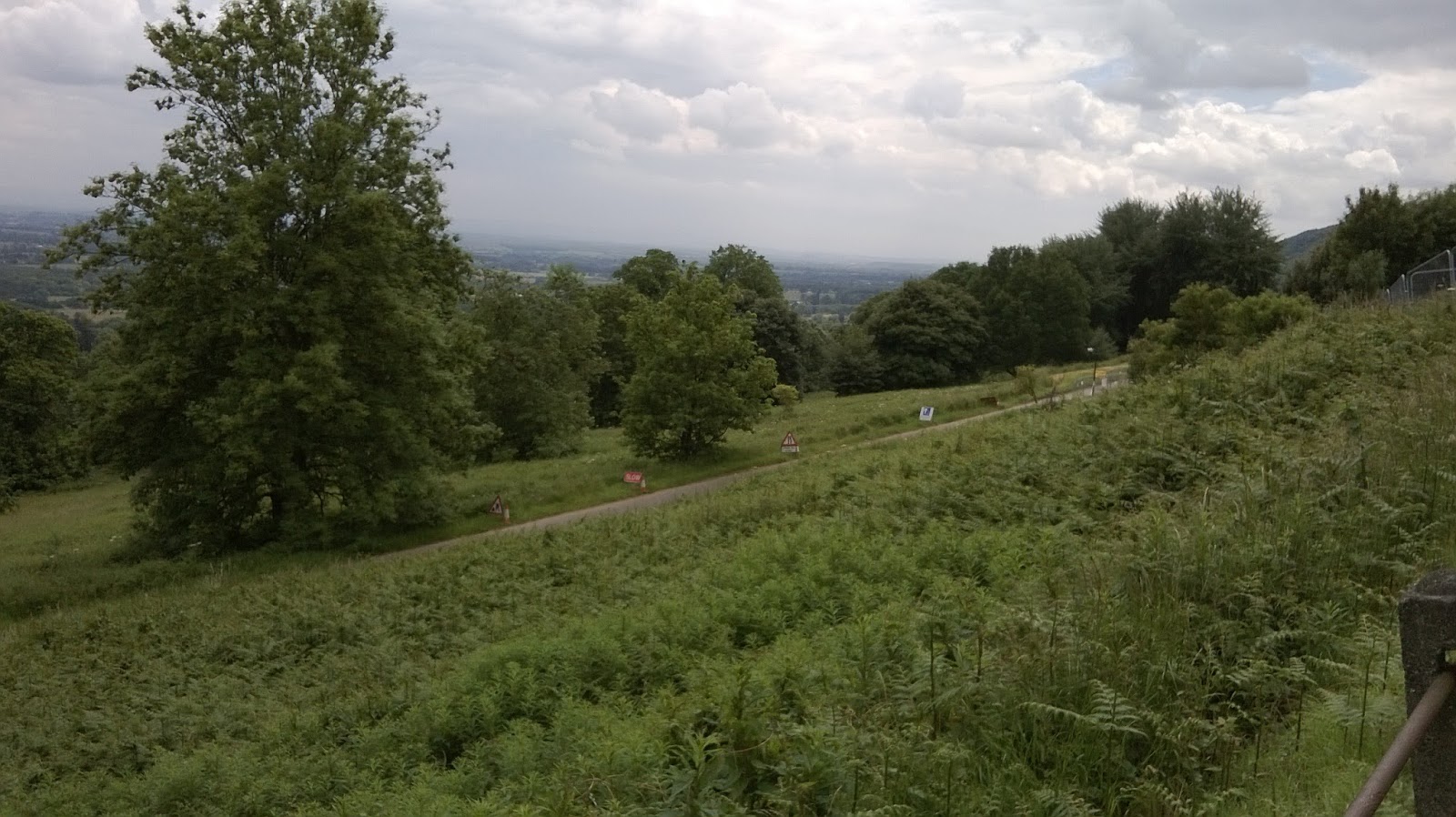
The Malvern Hills, of course, are much loved and much visited, but the last time I was here I couldn't see more than a hundred yards for mist and I wanted to test the truth of a local story that you can see all the way to Chepstow from the top. I still don't know; too hazy.


All the way to Chepstow? Who knows...

From here on, through the Herefordshire Marches and the mountains of South Wales, it is unspeakably beautiful. So I didn't plan to speak about it.  At this point, I got the sat nav out to do the map reading for me and let me concentrate on the glorious roads for a few miles.

Race-the-sun write-up Part 7 - Southam; Gateway to the Midlands?

I was about to swing around the little town of Southam and go on my way when I realised I'd never heard of it, which is a primary selection criteria for places to visit on these journeys.


In the town, I came across this first specimen of a half-timbered house I'd seen on the journey, and when I walked around, I noticed the people all sounded like Jasper Carrot. This must, I reasoned, be the start of the Midlands.


I came across a very pleasant, no-frills cafe with charming staff. The coffee was good, but the main attraction was...


...Pippa (that's the one in brown, not red), possibly the fussiest, slobberiest dog in town. She gave every passer-by the goo-goo eye treatment to ensure they took a couple of minutes out of their day to make a fuss of her and get slobbered. They all went on their way only minutes later about their business than they would otherwise have been, and slightly damper, but feeling so much happier with the world. Stirling work, there, Pippa!

...
Oh, and Upton Snodsbury. How could I pass by such a glorious place-name?

As it happened, I was passing just on lunch time so stopped at The Oak, Mark and Louise's excellent pub, which has great food and coffee, and a ceiling full of wine bottles! (http://www.theoakuptonsnodsbury.co.uk/) If you're West of Worcester in need of a break, I'd recommend it.


Race-the-sun write-up Part 6 - Watford Gap

Watford Gap is a low point (physically, not emotionally, for all the baggage the place name has acquired) between some inconvenient Midland undulations. It has hence been much favoured by wayfare builders over the centuries.
Just outside the village of Watford there is a little B road running West that, in the space of a few hundred yards, crosses four major lines of communication.


The Romans, who famously went for straight roads, to show natural objects who's boss, contrived to make one of their major routes go through the Gap.  Somewhat broadened but still arrow-straight, this bit of the road is in use today as the A5.


Later, canal and railway builders, who have very good reason to favour level ground, aimed for the Gap when building their major North-South connections.


Most recently, the M1, shown here with eponymous Services, has jostled through the Gap heading North. (Or heading South, depending on your geographical allegiances.)

Race-the-sun write-up Part 5 - Technophilia and the A14

The joy of technology. With WiFi almost everywhere
- like a service station on the A14 -
you can get on line and hold forth at the drop of a hat.
I'm sometimes astonished at how far behind the curve I have fallen with technology... I was one of the first to get a home computer in the days when 64k was massive. A phone graced my briefcase long before that of many a colleague. And yet I have only just figured out how to make my smart(er-than-me) phone connect to the Internet (and therefore Facebook) in the absence of a WiFi connection - surely a key capability on a blogged journey like this one. Fortunately, there is generally no shortage of WiFi providers, and in any case, I regard this more considered write-up while sitting calmly at a proper keyboard to be the real account.

The A14.... now there's a level of technology I understand: roads.

The A14 is certainly well visited though not particularly loved, which is a great shame. It is a very rare thing: a safe, fast highway that goes across the country instead of to and from London. It connects the ferry ports to Europe with the remains of our industrial heartland. I cadged a ride for a bit of it to speed me along into the Midlands.

Race-the-sun write-up Part 4 - The Fens, again.

The Bedford Level: flat lands and the Flat Earth.
My first stop was The Causeway in Sutton, a village between Ely and Huntingdon. The Causeway – which really is a causeway - is a very minor road that crosses the Old and New Bedford rivers, two artificial waterways that run absolutely straight and parallel for miles across the Fens, helping to keep the area agricultural rather than aquatic. (Actually, there’s a third one, the River Delph, but it’s little more than a ditch and you’d be hard pressed to spot it amongst the reeds.) The land around here is famous for its pitch black, incredibly fertile soil. It’s a huge natural gro-bag. But here, this strip of land between the rivers is a rare bit of a wilderness, making a peaceful place for a breakfast stop.
I remember from my geography lessons with Mr Golden at Swaffham Sec. Mod.: only the outside bank of the Old and New Bedford Rivers is built up above the surrounding land like most Fenland waterways. The water is allowed to overflow into the strip of land between them in the winter; a long, thin flood plain, and not at all suitable for the intensive arable cropping of the surrounding acres.
I also remember “Esso” Golden explaining that a famous experiment was conducted on the Old Bedford River to prove the curvature of the Earth. Three posts, all exactly the same height, were set up on boats spread out along a six mile stretch of the river. Sighting along the posts, the middle one appeared to be higher than the other two, so the Earth is round. QED. I discovered a related oddity that old Esso didn’t explain when I checked all this with Professor Google to make I was remembering it right. There were two or three such experiments. On the first go, the sight line was too close to the surface and the mirage effect made it look as if the Earth was flat after all!
I never have figured out why they went to all the trouble of mucking about in boats with theodolites and so on when they could have done much the same thing from any old quay, watching a boat sail out and over the horizon. I guess that the belief in a flat earth was so well established that some explanation or other for ships disappearing over the horizon was generally accepted. I’m sure this and the Bedford Level experiments all say something profound about the nature of scientific knowledge, but I’ll leave that for another day.

The space between the Old and New Bedford Rivers is allowed to flood in Winter.
(Clever old Dutch engineers designed it that way.)
This causeway allows the people of Sutton and Sutton Gaunt to stay in touch.

Race-the-sun write-up Part 3 - Setting off

The only trouble with long days... Short nights.
After a pleasant afternoon with sister Gwyn, fitting up a security camera, being fed (copiously), and catching up on the family gossip, I got an early-ish night and was up and away a little after three.

After a glorious ride across the rolling Norfolk countryside (yes, it does roll; don't believe that Noel Coward twaddle about it being very flat), I arrived at Ness Point, Lowestoft, to find myself very far from alone.

There were photographers aplenty, lining up their lenses to capture the moment...

... a couple of fellow middle-aged bikers also setting off to do the run to St David's...

... and even a sun-worshipping setter, keenly anticipating the dawn.

As it happened, nobody saw the sun rise for the clouds.
Oulton Broad here, where the North Sea meets the Norfolk Broads, looked positively moody about it all in the morning grey.

Race-the-sun write-up Part 2 - Getting to the start line.

I aimed to get to Norfolk on 20th in plenty of time for an early night in preparation for an early start on 21st. Other things to do while heading in that direction came to mind in the days leading up to the Sun Run - show Ma the holiday snaps from Italy, visit the family graves at Castle Acre, fix up a security camera for sister Gwyn - so I ended up sneaking out not long after dawn on the Thursday.
Sneaking out just after dawn on Thursday

Noticing my increasing inability of late to get from A to B without going via C and D for no good reason, I took the opportunity of this run to try out different navigational aids. There's the relevant pages from a map in the tank bag, the waypoint list in the little holder on the handlebars, and in extremis, there is the quite sophisticated sat nav on my new smart phone.  During the course of the run, I tried all three ... and yes, I still managed to go via C and D!


The early start certainly gave me a clear run. Purring along those dead straight Fenland roads in the early morning was particularly refreshing.  (One has to purr on these roads, not sprint. They may go straight for miles, but they flex as the millenia of peat under them expands and contracts. Going any faster than a graceful purr feels like being kicked at the base of spine at frequent but random intervals.)

Straight on 'till morning. Fenland straights are only 'straight' in the horizontal plain.


I called in on Ma to show her our holiday snaps. Not the best timing I've ever been guilty of, given that she's just had her eyes poked around with at the hospital. Still, I got to breakfast on copious amounts of bread and cheese and one of Ma's mamoth Eccles cakes.

Called in on ma with some trepidation; she always tries to nick my bike.
"It's just like my mobility scooter," she says.

Actually, seeing Ma try to figure out how to put my helmet on for this picture was way more amusing than my attempt at a humorous caption, here!


From Kings Lynn, I took the back roads to Castle Acre...


Isn't it funny how things you remember from your childhood
- like this lane between Southacre and Castle Acre -
alway turn out to be much smaller than you thought.


One object of my detour was to re-acquaint myself with this tucked-away beauty spot, a ford through the River Nar where children can paddle and catch tiddlers while the grown-ups picnic and take pictures of the ruins of Castle Acre priory.
River Nar, Castle Acre
(And yes, I did cop out and ride across the pedestrian bridge.)
Castle Acre priory across the meadows from the ford


Race-the-sun write-up Part 1 - Preamble amble.

Thank you to everybody for their interest and especially to those who have once again been inspired to dip into their pockets and make a contribution to Cancer Research UK (at http://www.justgiving.com/John-Seaman ).
Some people will have seen my write-up on my Facebook group already. It was a handy medium for publishing quick jottings and snapped photos literally from the roadside. Typing on a smart phone's touch screen 'keyboard' is somewhat limiting, encouraging shorter reports, but some would say that in my case, that is a blessing.  If I understood Facebook even half as well as my grandchildren - or even Mrs S, these days - I'd make it available to everybody. I may yet get that education, but in the meantime, here is my more leisurely write-up now that I am back home at my desk.

Monday, 27 May 2013

Race-the-sun run

I'm hatching a notion to ride from Lowestoft at sunrise on the longest day, 21st June, to St David's by sunset, once again stopping off at interesting and less visited places along the way.
It's not specifically for charity this time, but I'll blog it here and if anybody feels inspired by my drivel to click through to the JustGiving site and donate (another) few bob to Cancer Research UK, they are, IMHO, a fine and noble person.
Whether I actually do this is somewhat dependent upon a fairly hectic workload this summer. I'll post an update on the situation here.
Anybody on two wheels - or four, or three, or whatever - interested in joining in or meeting up on the way would all add to the interest. Let me know.

Friday, 14 December 2012

To all friends and family who kindly supported my recent "bottom-right-to-top-left" charity ride from Dungeness Point to Cape Wrath.
Alarming news received from James Mather who, inter alia, runs the ferry over to the Cape Wrath peninsula.
Hi, Hello from a very cold Durness. I am writing in an almost desperate mode to let you all know that there is a chance that Cape Wrath will become precluded from public access. A letter from within MOD has been sent to our local Member of Parliament (Lord Thurso) saying that if the final percel of land at Cape Wrath can be bought by MOD, then we as communnity, visitors and users may not have access and the land we now freely walk on may not be available to us in future.

If you feel in any way interested in what I have just said, please email me and I will send you the letter by return.

Durness village is seriously under threat in my opinion,

Please forward this email to everyone you feel may also be interested,

Yours, James Mather

James Mather
01971 511 284/07742 670 196
http://www.capewrath.org.uk/
You might say "Cape Wrath's a long way away" and you'd be quite right. It's a long way from anywhere; that's one of its charms.
You might say "I'll never go there," which may also be true, though you'd be missing a treat. Going to the corners of one's country at least once ought to be on everybody's bucket list, I feel. But even without that, it's a staggeringly beautiful place to go.
But my reason for passing this on to you all is that I think you might share my concern that we need to kick up a fuss when the bigwigs try to drive us off bits of our country. We largely won that battle against the rich land-owning bigwigs with the Right to Roam legislation. But we also need to keep an eye on corporate and governmental bigwigs; in this case, the MoD, who will chase us off great swathes of the country on the pretence of it being necessary for the defence of the realm. And just like my charity ride, this is enlightened self interest. If nobody stops them demanding the use of a bit of land there, who's going to stop them demanding the use of another bit of land here? A bit of beach near you might be just what they want for firing cannons; a heath just down the road might be "essential" for manouvres.
Visit the website above. (Visit Cape Wrath, too, some day, but a click on the link is easy enough to do right now!) Send James a message to let him know there are loads of people out there who are concerned.
John

Saturday, 12 May 2012


Homeward bound, part 2. Knutsford to Poole

I had a pleasant, not hugely eventful run home, for the most part in glorious sunshine.  


Stopping at services near Stafford to fill up my flask, I came across another temptress.
Another temptress
"Would you like a bar of chocolate for a pound to go with that?"
Merciless vixen.


The joy of motorcycling

I noticed quite a few motorcycles out and about, now the weather is getting better.  There's always a certain cameraderie between riders - a nod as one passes, a couple of words exchanged in car parks - and this despite the great variety in motorcycles and their riders.  There are old men like me on sedate tourers, younger blades (well, forty-something, anyway) on hideously fast sports bikes, teenagers on screaming mopeds.  In Fort William, I even passed a platoon of lads on mud-spattered motorcross bikes; curious things specifically designed to be ridden standing up, with just a token of a seat wedged between the back wheel and the engine.  And yet there is a binding thread; we all share the enjoyment of this bizare form of transport: two wheels that rely on gyroscopic forces to keep upright, for heavens sake, and then compound the madness by adding an engine to it.


Rejoining the motorway after the Stafford services, I came across a couple of interesting variations on the theme.  First a tricycle based on a large cruiser-style bike.  There were two people on the bench seat behind the rider, chatting away and obviously enjoying the ride.  Just ahead of them, clearly part of the same party since they shared the same custom paint job, was a Honda Goldwing (that's the massive, 1800cc, twenty-odd grand behemoth) with a sidecar attached.  I passed slowly, taking a good look at these; excellent solutions for passengers who can't manage a pillion seat - like Mrs S - or who wriggle around compulsively - like young Charlie.  
But surely, you might say, this misses the point of a motorcycle, namely having two wheels, not to mention loosing the ability to filter through lines of congested traffic, and limiting the (ability to safely exercise the) performance of the machine.
True, but with a trike or a sidecar outfit, one is still out there, experiencing the environment one is passing through.  It's a little difficult to explain if you don't already get it.  But tell you what; next time you see a dog with his head out of a car window, ears flapping in the breeze, big doggy grin all over his chops; pull alongside, wind your window down and ask him what he gets out of it.
  

A familiar road and a diversion

This is a familar neck of the woods for me: M6, M5, M4, A350 all the way to Poole.  That said, I noticed a motorway sign warning of congestion around the M4/M5 junction.  Motorway congestion is not a huge problem for a motorcycle, but I used it as an excuse to turn off early and enjoy riding a few miles across the Cotswolds. 
Not really needed


One thing that is very obvious is how much more the season is advanced the further South one travels. While the highlands are still brown, the Cotswolds were a chequerboard of vivid yellow and green. 
Greener (and yellower) towards the South


Pausing for thought

On my final stop, I noticed that I had by chance pulled up at the same spot I made my first stop at on the outward journey of my interim, left-to-right trip last year.  There's appropriate, I thought, so I sat down with the last of my coffee and had a quiet word with whatever divinity is responsible for charity motorcycle rides. I only meant to give a quick acknowledgement for it all going so well, but it rapidly turned into the breathless litany of thanks one hears from lucky starlets at the Oscar ceremonies.  Thanks to my IAM coach for making me sharp enough to ride without incident for over two thousand miles, to my wonderful wife who encouraged me to go even though she is poorly and could do with some nursing - even my cack-handed attempt at it, to the kind and generous people I encountered on the way, and so on and so on.  I particularly gave thanks for the previously undetected corner of the inner Seaman that is actually a people person so that I could speak to those kind and generous people.  (Some people who know me will surely be wondering if it was really me doing the ride or my secret jovial twin brother.)


That's all folks.


But most all, I gave thanks for all the friends and relations and friends of friends and relations for making it worth doing for Cancer Research UK

Stats for anoraks

Distance:

  • Poole to start at Dungeness Point: 183
  • Dungeness Point to Cape Wrath (left bike at Keoldale): 1007
  • Homeward run: 823
  • Total: 2013


Stops: 35


Fuel used: 156.84l, 37.58 gallons
mpg: 53.6 (that's good for a big motorcycle)


Spares and repairs: none; it's a Honda.


Homeward bound, part 1. Balmacara to Knutsford

Crikey! It's a long country when you travel the length of it in one go.  In fact, from Balmacara to about half way down the country is seven or eight hour's drive alone, even without breaks, so I put in one last overnight stop.  As I've said all along, there's no point raising a few shillings for Cancer Research if you then go and cost the NHS thousands by getting overtired and having an accident.


A nice spot for yet another full breakfast; the Balmacara Lodge.


After a hearty breakfast - though slightly unconvincing coffee - at the Balmacara Lodge, I proceeded in earnest down the A87 then A82, all the way to Glasgow, then the M74 and M6.  


Once again, I failed to call in at An T Sraid (which I have an idea is gaellic for 'The Street') where my old friend Peter - motorcyclist, musician, medic, all round good egg - lives in highland splendor.  Having promised for ages that I would come and visit him on my motorcycle, the very week I come by is when he is away on some far flung oil rig.  NEXT time, then, Peter! 


The route swung by many another interesting spot, but there was little time to stop and stare this time.
Hotel at South Ballaculish


There was, for example, South Ballaculish, which is noteworth for being further North than Ballaculish, as well as being the place I made Mrs S cry - in a good way.


The Ballaculishes are at the end of Glen Coe, which, according to the folk song, is swept by a particularly cold snow.  
Maybe that's why this mountain is called the Pap of Glen Coe


Can't come to Scotland and not take a picture of some pipes.


One of several quick stops on the way was at Inveruglas on the banks of Loch Lomond.  This is just opposite a very fine hotel at Inversnaid, which can only be accessed along several miles of barely car-wide tracks, and then only by those brave enough to dodge the monster luxury coaches of the Lochs and Glens holiday company who base their tours there.  (Give them a google if you fancy a cheap, no-frills holiday in the Highlands.)  But rather than romantic waters or distant hotels, here is a much more interesting picture of the hydro-electric installation at Inveruglas.  Water is pumped up to a man-made loch behind the mountain in the background, then allowed to gush down again to generate a blast of juice when there is a surge in demand.


The song I mentioned there - 'Cold is the snow that sweeps Gen Cloe' - got me thinking irreverent and disrespectful thoughts.  
"Aren't the Scottish lucky.  Every little town and village can lay claim to some historic internecine blood bath or, as with Glen Coe, scene of outright ethnic cleansing.  And with not too much of a selective reading of history, the blame can usually be laid entirely at the feet of the English.  So lucky; scenery, history and an easy conscience."


Well, you can tell I hadn't had an adequate coffee fix that morning, can't you?  I was probably also on a bit of a downer having come to the end of such a wonderful journey.
My mood was not helped by an icey rain that started as I crossed the already desolate Rannoch Moor and kept on more or less solidly until after Glasgow.  Glasgow in the rush hour in the rain when you've already got the last-day-of-holiday blues is a particularly depressing experience.


But eventually the rain gave way to a sunny late afternoon as I trundled down between the Pennines and the Lake District, and this started to work its magic, chasing out ungenerous thoughts. I was just starting to think how nice it would be to continue on through the Peaks and over the Cotswolds to home on a pleasant early summer evening, but I noticed that a pleasant weariness was descending upon me.  The sort of 'pleasant weariness' that has you suddenly realising that you are 20 feet from the truck in front and closing without knowing how it got there.


The next services with a hotel will do for an overnight stop, I thought.  Of course, it had to be Knutsford.  It features in my personal map of Britain, as I mentioned in passing in last year's blog, for being what I thought was the tackiest, nastiest, shabbiest, most shameful motorway services in the whole of Britain - and there's a lot of competion for that position.  But I lucked out in that the nearest Travelodge is actually outside the services, a couple of miles off the motorway towards Knutsford itself.  (Not actually in Knutsford; that's far top posh a town for a cheap hotel.)  


Not wanting to give the services a miss altogether though, I called in in the morning for a blast of Costa's overpriced brew and to make use of their free internet connection to upload this posting.  


One further post tonight when I get home will contain the stats - distance covered, petrol burned, etc. - just for the record.


Thanks to all my readers and generous contributors.  Hope you've enjoyed reading along with me as much as I have enjoyed the journey. 


Now it's back to the poorly Mrs S, hoping to enthuse her with the idea of doing it all again with me when she gets better.


Thursday, 10 May 2012


Talmine to Cape Wrath then on to Balmacara

The Cloisters, Talmine

This is a beautiful place to stay.  The view from the room made up for not having an Internet connection to update my blog.  
Still, I can't help feeling the geographers missed a trick by calling it 'Tongue Bay' rather than 'Mouth of Tongue.'


I set off a little later than usual on this final and shortest leg of the ride as the earliest breakfast was at eight - which is of course quite normal for B&Bs - but it was worth the wait: a magnificent Scottish breakfast (i.e. a full english plus slices of haggis.  I educated some French guests about the benefits of these meals.  Standing outside before going into the old chapel building for breakfast, a lady from this non-Anglophone family indicated that I must surely be cold, standing there in my short-sleeved shirt (flat hand chopping motion at elbow level, self-hug + mock shiver, say 'cold').  Using the same language, I indicated that a hearty English breakfast not only makes you fat but insulates you against the cold (say 'petit dejeuner Anglais,' pat stomach expansively, wipe imaginary sweat from brow and puff cheeks).  Who needs Esperanto, eh? 


Excellent hosts and very generous people


When I went to settle up, having squeezed my increasingly bloated form into the riding gear again, my hosts for the night - Bob and Audrey I believe there names are - very generously contributed the cost of the stay to my charity fund.  I'll be logging on to the justgiving.com/John-Seaman site soonest and making a paymernt on their behalf.


Oh go on; just one more bridge picture.
This one is a better shot of that last bridge over the Kyle of Tongue.


Durness

The ride to Durness was beautiful: A well-maintained road with wide, swooping curves and long straights across the high moor, (two-track up to Loch Eribol), sun on my back, snowy mountains in my eye-line, bike whispering along.  But a macabre thought kept entering my head: I had actually died in some squalid, rainy accident on the A1M and I was now actually in heaven.  Perhaps it was because an animal had died in my hands earlier in the morning.  (No, I hadn't caught my own breakfast.  One of the little birds hopping around a feeder at the B&B was in obvious difficulty on the ground.  It was clearly dying and I decided that I wouldn't cause it any more stress than it was already in by picking it up and moving it out of the path for it's last few earthly minutes.) After a little thought, I realised this could not be heaven.  As good as this moment was, it was not perfect.  Mrs S was not on the back saying 'Oo! Pretty!' and 'Look! Buzzard!' on the headset.


I called in at the Information Centre for a quick nose around and to check whether the ferry to the Cape was running.  While there, I overheard Helen here actually say 'och aye' to somebody on the phone.  This is the very first time in all my visits to Scotland I have heard somebody say that without irony.


What's that red rock doing here?


After civil engineering, it is geology that rocks me. (Sorry.) This whole area is a rock-hunter's playground, but it's also where some fundamental observations were made that effectively got geology started as a science.  At Durness in particular, something called the Moyne Thrust can be seen.  Basically, a huge wedge of sandstone was found about sixty miles from where it obviously originated, and whatever had shoved it there had generated enough heat from friction to turn some of the sandstone into other sorts of stone.  (Schists, if you really want to go anorak on this.)  This got people thinking about how lumps of rock go slithering around the earth and changing from one thing to another.


(Tell ya what, though.  Walking down fifty feet of steep path to the beech and across a couple of hundred of yards of sand had me puffing.  I need to have a good think about my fitness levels before I go hiking across the mountains with my little geology hammer in my hand.)


Cape Wrath

Finally, I rode the last couple of miles to Keoldale where a ferry carries people across the Kyle of Durness and a minibus takes them the ten miles or so to Cape Wrath.


For such a small ferry, this is a big queue.


I arrived in good time for the 11 o'clock sailing, which was just as well.  The minibus only takes 16 passengers and I got the last seat.  A couple on bicycles went across to ride out to the Cape, but otherwise, people had to wait for the 2 o'clock ferry and bus.


The road to the Cape winds its way across acres of peat bog, crosses a military range, and needles across some very old bridges that were built in the days before anything as wide as a Ford Transit had been thought of.  The boys from Time Team might be able to find evidence that it once had tarmac on it, but now, the bus has to take it very steady indeed.  Giving relief from the lurching and plunging, the driver stopped to give a bit of a commentary on points of interest along the way - and stopping was essential.  


Breath in!


At the very tip of the Cape is a lighthouse.  It was once operated by a crew of three who lived out there with their families.  It's now automated and monitored from Edinburgh.  
The lighthouse at the other end of the country (from Dungeness)


Once supporting a number of crofts, a husband and wife couple are now the only permanent residents of the peninsula; they run a bit of a cafe in one of the outhouses in the lighthouse complex.


Making a big show of checking the compass on my (very expensive gift from Mrs S) wristwatch, I loudly declared a particular bit of rock at the top of the cliffs to be the exact most North-Westerly point.  Other sticky out bits that people suggested I dismissed as being 'too North' or 'too West.'  Such is the power of loud declaration (especially if you are wearing a tie), that everybody then queued up to take each other's photos standing on the spot!  The thought crossed my mind that I'd never forgive myself if anybody went over that precarious little bit of rock, but I got away with it this time.


This is the spot...


...and me standing on it.
If I'd turned around, dived in and started swimming, the first land I touched would have been Siberia.


To while away the long hours on duty, the lighthouse keepers developed this novel musical instrument from driftwood and scrap metal.


Scratching post.


On the way back, the driver pointed out a young eagle in flight, and we saw a herd of hinds trotting across the bog with their fawns - none of which comes out in my phone-camera photos, of course.  Another more human oddity was the line of telegraph poles marching across the landscape.  These brought telephone lines to the lighthouse and to the military forward observation post.  Having erected all 480 of them, they found that they were felled by storms at tediously frequent intervals, so the cables were laid underground instead.  Many of the now redundant posts were 'recycled' into firewood by the crofters.  The driver pointed out one of the remaining ones which had become a gathering spot for the deer.  In the absence of trees, they used this to rub the velvet off their horns.  In the process, they had trampled away all the peat from around the base exposing the underlying rock.  


All done

Well, that's the journey's end reached.  I see we've raised £770 for Cancer Research UK, which is a quite respectable chunk of my £1000 target.  My sincerest thanks to everybody who contributed - especially those who allowed me a second bite of the cherry!  


The journey was also my annual holiday as well as a fund raising venture, and it has been the best ever.  And I still have the length of the country to ride before it's over!


This is typical of the scenery one passes through in the North West corner of Scotland.


In the absence of an internet connection last night, I had to wait until today to upload the Kinross-to-Talmine leg.  At Ullapool, the Information Centre directed me to the Caley Inn.  A very quiet hostelry at this time of day.


Angela and Tony's 

After Ullapool, I caught up with the really cold and wet weather I'd seen on the forecast yesterday.  On the long, long road to the Kyle of Lochalsh, I pulled over to pop the sweatshirt on and to do up a few extra zips on my suit of many layers.  Sorted.  But I was still glad to arrive at Angela and Tony's Balmacara Lodge for the night.

If the forecast promises a repeat of those temperatures tomorrow, I'll get my new heated inner gloves ready.